Thursday, 19 July 2012

THE ROAD TO MACHYNLLETH

The cycle path beside the River Dyfi leading into Machynlleth was completely covered in cow pats.  There were so many that it was impossible to navigate around them.  It is at times like this that you realise nature has the upper hand.

I left Llandudno, a mixture of Victorian grandeur and pre-war suburbs and cycled back into Snowdonia.  I passed under the ramparts of Conwy Castle and at Betws-y-Coed found many visitors on real and imagined adventures on their ways into the hills.  At Blaenau Ffestiniog the hills had been carved into quarries where some of the finest slate in the World still comes from.


Further on at Trawsfynedd, a redundant nuclear power station stands sentinal overlooking a lake of the same name.  However by looking south, the lake is incredibly beautiful.  The cycle path winds alongside it and cars on the nearby highway completely miss this spectacular scenery.


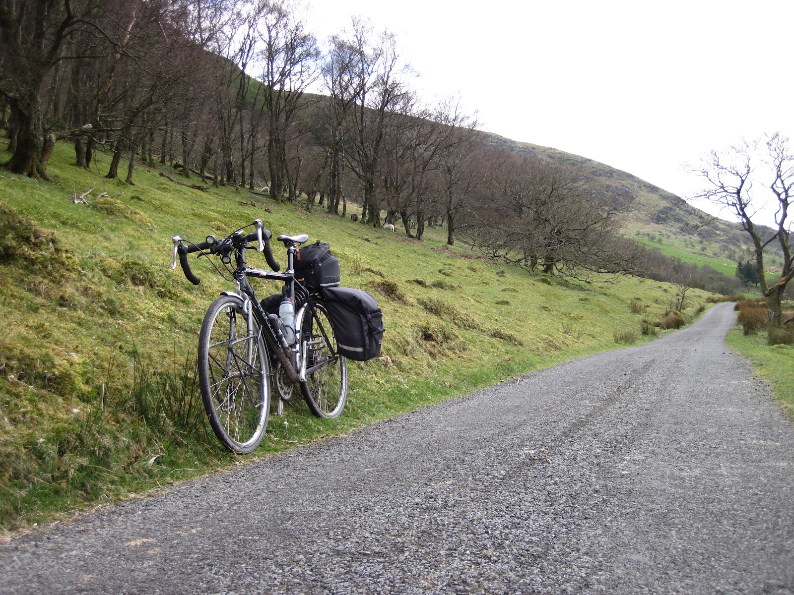
My overwhelming impression was that I was cycling through Snowdonia's finest scenery as I headed for Dolgellau and Cader Idris.  It was 150 years ago that gold was dug from the River Mawddach but it is not possible to see this anymore as the river had reclaimed its rightful place.  The cycle path wound its way up again into the hills.


Machynlleth was 70 miles from Llandudno.  It believes that it is the true centre of Wales.  It sits nestled in the hills and feels like a proper community.  I stayed at The White Lion Coaching Inn for the second time having cycled through here twice before.  The imposing Victorian clock tower in the centre of town was funded by local people and is a fine monument.

Sunday, 15 July 2012

CHALLENGE THE DRAGON: DAY 1

This was the start of a mini-adventure by bike through the heart of Wales.  On day 1, I joined The Balti Bike Club at the Castle Car Park, Stafford for a 127 mile cycle challenge to Llandudno.


Cycling in Staffordshire is not like Devon.  There are hardly any hills.  We sped along at an average speed I am not used to for the first 60 miles.  We passed through Newport and Wem.  The hills appeared as we entered Powys and there was a steady climb to Lake Vyrny where we stopped for lunch.  The BBC, as they are known locally, have a fantastic group of supporters.  We were cheered and filmed as we went and at lunch out came tables, chairs, drinks and food.


After lunch, we climbed up into the hills on small minor roads as we headed for Bala.  It was slow steady progress but going downhill on the other side was another matter.  One cyclist reached 47mph but he had to be brave to dodge the potholes and stray sheep.


After Bala, we climbed again into scenery that I just love.  It was wild and remote.  We were rewarded with spectacular views of the mountains set in mist.  We pedalled to Llanrwst where there was a spectacular downhill.  We thought that the final 10 miles would be an easy ride along a river valley to Conwy and Llandudno but there were two final hills entering Conwy that needed an extra boost from our tired legs.

I want to give special thanks to Balti Bike Club for allowing me to join them on this challenge.  The next part of my "Challenge The Dragon" is to cycle from Llandudno to Chepstow and Bristol.  My route is shown below and it retraces through Snowdonia, then heads south through the Cambrian Hills and Black Mountains. 

Friday, 22 June 2012

WAY OF THE ROSES

The Way of The Roses Cycle Route is 170 miles from Bridlington in Yorkshire to Morecombe.  It is a route divided into two halves.  The east section to Ripley is a fast ride with light hills but there it abruptly changes as it climbs high into the Pennines over to the west coast.


I met my buddy, Andy at Bridlington Train Station.  This must surely make a claim to be one of the most stunning stations on the whole rail network.  It had an old world charm that was supplemented by tables of local food, flowers, historic photos and friendly people. 


It was soon evident that this is a popular cycle route.  We saw cyclists on every section of the journey and, in turn, we were rewarded with interesting cafes, good pubs for stopovers and some eye catching scenery.  As usual on the National Cycle Network, we encountered few cars.  Millington, mid way between Driffield and York probably claimed the best cafe judging by numbers of cyclists who stopped there.

The cycle route made light work taking us past York and Ripon cathedrals.  It abruptly changed as we approached Brimham Rocks.  Our imaginations stirred as these ancient rock formations resembled Dartmoor's famous tors and had peculiar names such as Dancing Bear, Pink Panther and Watchdog.  We dropped down into Pateley Bridge on the River Nidd only to find the first of several challenging hills.  Andy must have done some special training as he took the hills with relish leaving me trailing behind.  "Must do better" appeared in my notebook several times. 


We peddled on to Settle passing another cyclists' cafe at Cracoe.  I find the experiences to be special when cycling among high open moorland and hills.  Cyclists kept coming in the opposite direction and we encountered riders of all ages.  Many appeared to be on long distance tours while others were challenging themselves on day rides.  At Settle, we left the route and headed north to beyond Kendal where we briefly joined the Walney to Wear Cycle Route.  Finally we turned around and cycled back to Lancaster for trains home. 

The total distance for us was 210 miles.  Where next? Croatia for Andy and Wales for me.


Wednesday, 13 June 2012

17 HOURS IN THE SADDLE

I completed my 150 mile challenge on Sunday despite the rain.  It rained all day and severely tested my wet weather gear.  Journey's end was near Slimbridge in Glos where for some reason there was still some gas left in my tank.

Starting at 4am, I reached Exeter without seeing people.  Haldon Hill which I dread was passed early on.  I did not see the sun rise because of dense clouds but I did see lots of wildlife taking advantage of  the early morning with rabbits scampering everywhere, deer grazing in the fields and birds overhead.


I needed a break in Cullompton and looked for a bus shelter, always a good place for a cyclist to rest in the rain.  I joined a National Cycle Route at Taunton and this took me beside a canal to Bridgwater.  Lots of people were out walking.  This stretch was very scenic as I was now heading into the Somerset Levels.


At Portishead, I had cycled 125 miles.  It was raining hard and gravel had got into my gears making them hard to operate.  My map was soaked and falling apart.  Bristol is complicated to navigate on a bike and for some reason the council had taken down all the Cycle Route signs and substituted them with different ones that did not tie up with my new soggy wet map.  I was at my lowest ebb.  I took a break in the dry under a motorway bridge and somehow it lifted my spirits.  I set off and found the mighty Avonmouth Bridge despite the almost complete absense of signs. 

Once over the bridge, the signs were all in place and it proved to be fairly easy navigating through Avonmouth and onwards into Gloucestershire.


I have cycled the little lanes beside the River Severn north of Bristol earlier this year and they are a good ride.  My energy had unaccountably come back and it was with much enjoyment I peddled up to the 150 mile mark accompanied for the last 6 miles by my wife.  If the weather was better, I would like to have carried on until it was dark but the thought of a hot bath and dry clothes was a better option.


Sunday, 3 June 2012

MY 150 MILE IN A DAY CYCLE CHALLENGE

It is only one week to go before I attempt my longest one day cycle challenge. The date is set at 10 June 2012.

I have done lots of cycling and been to many places on my bike but never before have I tried 150 miles in a day.  I am finding that this is a daunting but very exciting challenge that I must do.

The journey starts in Ivybridge, Devon with a 15% hill outside my house so there is no time for a gentle warm up.  The end, legs permitting, is close to Slimbridge in Gloucestershire.


Using minor roads unless major roads are unavoidable, the route will often follow the National Cycle Network (NCN).  I will cycle the southern fringes of Dartmoor through Ashburton to Exeter which includes a long climb across Haldon Hill.  At Tiverton, I join the NCN and head to Taunton.  This also looks hilly in places but after Taunton there could be a good length of easier cycling to Bridgwater, Axton and Clevedon.  Entering Bristol, there is a cycle path alongside the M5 across the Avonmouth Bridge.  This is very high and windy on a bike.  There is continuous NCN from the bridge to Slimbridge as the last section winds its way north close to the River Severn.  Apart from the industrial parts of Bristol that I will go through, I have high hopes of a delightful scenic journey............... unless my legs give out or I collapse from exhaustion thus never seeing it.

The bike is my Trek X0.  This is my trusty cyclocross converted to touring.  It is no lightweight racer but it is strong and rugged.  It has now done 15,000 miles and never let me down on important rides.  I will carry food and drink with me making stops on route to replenish.

Am I prepared?................  I am doing all my training and have taken tips on food and drink.  My bike and legs do not permit high speeds.  Like this morning when I was out and overtaken by two navy guys going twice my speed, I get frustrated when I see others who I feel are much better than me.  I just believe that it is always important to challenge yourself.

If you would like to support my challenge, please go to http://uk.virginmoneygiving.com/GrahamWilson150  . 

Monday, 14 May 2012

HEART OF DARTMOOR CYCLE CHALLENGE

40 Cyclists took part in the first Heart of Dartmoor Cycle Challenge organised by Devon Wildlife Trust on 12 May.  At 50 miles, the route attracted riders with a wide range of abilities with many coming from all over the country. 

Many were skilled racing cyclists attracted to a new route while for others it would stretch their abilities.  The common theme was that all wanted to experience the wildness of Dartmoor.


I lead a group of 10 cyclists on a route that included an off-road section.  Another group followed the fully on-road route while others had to use their map reading skills as they set out on their own.

Starting and finishing in Ivybridge, we started by following Dartmoor's rugged southern boundary via Shipley Bridge.  We rode through woods, alongside rushing rivers and past remote farms.  At Buckfast, we turned north to climb up on to the high moors with Princetown being the highest point.  We had managed to spread out here and most needed to recharge energy levels with a mixture of cream teas, pasties and chocolate bars.  We twice crossed the upper reaches of the River Dart.


The scenery via the off-road route from Princetown was breathtaking with unspoilt open moorland and Dartmoor's famous torrs all around us.

The Trust laid on refreshments at Holne and cycle repair facilities were provided on route by Big Peaks of Ashburton

It is hoped that the event will be repeated in 2013.

Saturday, 5 May 2012

LON CAMBRIA

Fresh mountain air, red kites, forest trails and secret river valleys greeted me on my cycling tour of Wales at the end of April.

My trip started at Gloucester.  I rode north following the Malvern Hills and River Severn until just outside Shrewsbury where I turned west and my route crossed into Wales.  My destination was Fishguard on the Pembrokeshire coast.  I planned to follow Sustrans cycle routes nos 81 and 82 known as "Lon Cambria".


Cycling in Wales always feels like a mini adventure and I come alive on these trips.  I started on little tiny roads.  Sometimes they changed to woodland tracks more suited to mountain bikes.  Much of my journey was little visited and felt remote.  I pedalled into Welshpool and on to Llanidloes pearing at hill farms plentiful with sheep and lambs.  It was early Spring.  The rivers were slightly coloured and leaves were starting to form on the trees.  Daffodils were still out and primroses were plentiful on the lower slopes.


I crashed out for the night at a pub in Llanidloes just seen in the distance in this picture.  It was not before having 2 pints of local ale, a big meal and a long chat with a hill walker.  Shortly after leaving Llanidloes, I met a local couple at the top of a hill who were marvelling at the view.  They told me that it still snows here long after it clears elsewhere in Britain.


A tiny lane took me to Rhayader where there is a bike shop.  Parked outside was an expedition bike with a trailer.  These are huge rigs for long journeys.  The last one I saw was in Sweden being ridden by an Australian cycling north.  I changed direction on to a stony trail that headed up the Elan Valley well away from the cars.  My highest point was amidst open moorland and the air was clear, fresh and cool, absolutely brilliant.  The onward journey to Fishguard took me down a steep windy road, passing a redundant slate quarry and towards the head waters of the River Tiefi.


A deep woodland trail followed and 3.30pm I found a small shop for lunch.  Outside with the sun shining were two hill walkers taking a mid point break.  The shop served me what it called an oggin and looked like easily the biggest pasty I have ever seen.  We swopped tales of hill walking and cycling then shook hands as we left.

I now followed the River Tiefi for its entire length.  It is a beautiful river.  The valley looked to be a haven for wildlife with a mixture of water meadows, forests, hills and occasional bogs.  The final stretch of the journey involved a loop into the Preselli Hills only to find more crags, woodlands and river valleys.

My total journey was 268 miles over 5 days and there are train connections at each end.  The map can be bought from Sustrans Shop.